
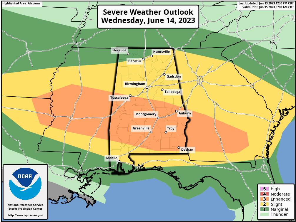
After quiet and calm weather the past few days, an active pattern has returned to the area. The Storm Prediction Center has much of Southern MS, AL and GA in a rare (especially for June!) Level 4 out of 5 Moderate Risk for severe weather today. The last time we’ve had a moderate risk in these areas in June was in 2002!

As we break down the threats, notice the area in SE AL that is highlighted for a chance of strong tornadoes (EF2 or greater) today. Also, widespread damaging winds will be possible to our south. 
Notice we are also in a risk here in the Shoals area. Our threat comes with damaging winds and maybe some hail with the stronger storms. A Severe Thunderstorm Watch has been issued to our SW that goes through early afternoon. More watches will be issued later today across the region.

After today’s active weather, we may have more strong to severe storms on Friday locally, and then again on Sunday! The SPC already has us in a Day 3 and a Day 5 risk!


As always, Stay with Shoals Weather. We will keep you updated!
